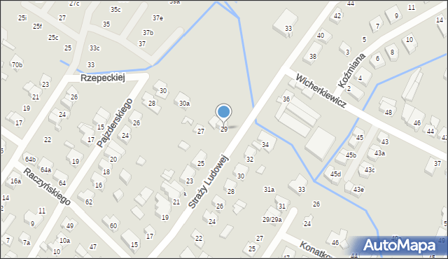
Straży Ludowej 29
Mapa Targeo
Adresy Poznań
Wstaw tę mapkę na swoją stronę
lub utwórz własną mapę w
Kreatorze map Targeo
Warunki korzystania z Targeo MapShot
Przejdź na dużą mapę
Przejdź na dużą mapę
Poznaj sposób na uporządkowanie bazy danych adresowych
Straży Ludowej 29 (ul)
60-465
Poznań
(Poznań-Jeżyce)
Gmina Poznań
Powiat Poznań
Województwo wielkopolskie
Ulice w pobliżu
Poznań, Straży Ludowej, Ulica (60-465)
Poznań, Pajzderskiego Nikodema, Ulica (60-469)
Poznań, Zaleskiego Zygmunta, Ulica (60-465)
Najbliższe obszary kodów pocztowych
Kod pocztowy 60-469
Kod pocztowy 60-479
Kod pocztowy 60-467
Punkty w pobliżu
Łukasz Urbański, ul. Gertrudy Konatkowskiej 45, 60-465 Poznań
MDT Agency Co LTD, ul. Cieplicka 20, 60-472 Poznań
Gruba Ryba- Sklep wędkarski, Obornicka 337, 60-689 Poznań
Jaz ruchomy, Strzeszyńska 79/81, 60-479 Poznań
Adresy w pobliżu
Poznań, Straży Ludowej 27, Ulica (60-465)
(→ 24 m)
Poznań, Straży Ludowej 32, Ulica (60-465)
(→ 42 m)
Poznań, Straży Ludowej 25, Ulica (60-465)
(→ 43 m)
Poznań, Straży Ludowej 34, Ulica (60-465)
(→ 46 m)
Poznań, Pajzderskiego Nikodema 30a, Ulica (60-469)
(→ 49 m)
Poznań, Straży Ludowej 30, Ulica (60-465)
(→ 52 m)
Poznań, Straży Ludowej 23, Ulica (60-465)
(→ 64 m)
Poznań, Straży Ludowej 36, Ulica (60-465)
(→ 72 m)
Poznań, Straży Ludowej 26, Ulica (60-465)
(→ 80 m)
Poznań, Rzepeckiej Heleny 37e, Ulica (60-465)
(→ 135 m)
© 2003-2025 AutoMapa Sp. z o.o.
Moje Targeo
Kreator map
Zgłoś uwagę
Dodaj punkt
Panel użytkownika
Warunki użytkowania
Funkcjonalności
Geokodowanie
Trasy i traffic
Geomarketing
Monitoring
Funkcje API
Targeo PRO
Usługi dla biznesu
Kurierzy
Spedycja
Taksówki
Sieć sprzedaży
Reklamodawcy
Strony WWW
Informacje
Oferty pracy
Pomoc
Regulamin
Polityka prywatności
Kontakt
Kontakt dla biznesu
Ustawienia plików cookie


 Łukasz Urbański, ul. Gertrudy Konatkowskiej 45, 60-465 Poznań